Map of Tufts College in 1938. In the lower right corner, you can see the new Cousens Gym north of College Avenue the rest of the undeveloped Stearns Estate. The building to the west of Cousens Gym was originally College Station, but at this time it had been home to Tufts University Press for some time.
Map of Tufts College in 1929, less than a decade after the Stearns mansion was torn down. In the lower right is College Avenue, labeled "To Willows + Medford," referring to the street's nickname. Arrows also indicate that the Site for New Gym and the Tufts College Press are located to the right of the railroad.
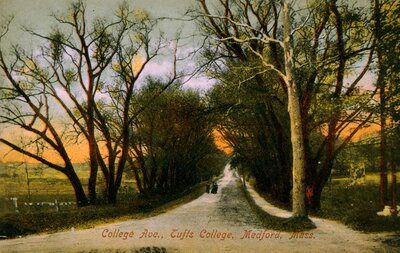
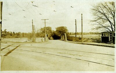
View towards Medford Square from the top of College Hill (Tufts College), ca. 1910. The tree-lined Avenue stretching left to right is College Avenue, also known as The Willows. The Boston & Maine Railroad parallels the bottom of the image, with College Hill Station appearing at the bottom left. Behind the station is Pansy Park, a pansy nursery. To the left of Pansy Park is property belonging to the Stearns Estate. Across College Avenue are the clay pits.
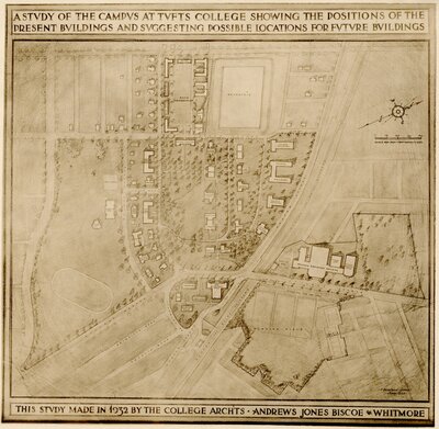
Map of Tufts College showing buildings present in 1932 and possible sites of future buildings. In the lower right quadrant, note the presence of the Physical Education Building (Cousens Gymnasium) and possible future additions northwest of College Avenue, as well as a large plot of the Stearns Estate yet undeveloped. In 15 years, this property would be home to Stearns Village.
Attribution:
College Architects: Andrews, Jones, Biscoe & Whitmore
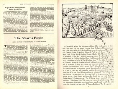
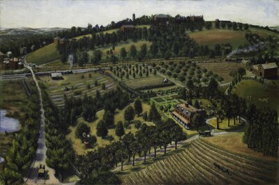
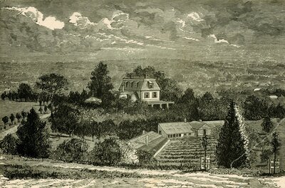
Article titled "The Stearns Estate" by Justin Wyner, describing the 'Stearns Estate, 1899' painting by William Hauk. This article was published on pages 10-11 of the Spring 1945 edition of the Tuftonian. A black and white copy of the painting was featured on the front cover.
This painting shows the Stearns mansion in the center right and the farmhouse to the far right. In the distance on the hill are the buildings of Tufts College, with the tower of Goddard Chapel, East Hall, and West Hall visible through the trees. The road to the left is College Avenue; at the time it was known as the Willows because of the trees on either side. At the corner of College Avenue and the railroad tracks is College Hill train station. The Boston & Lowell Railroad operated on the tracks that separated Tufts College from the Stearns Estate's orchards.
Attribution:
William Hauk
Attribution Statement:
Image courtesy of the Tufts University Permanent Collection
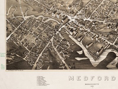
Excerpt from the Brainard map of Medford, 1880, showing South Medford. The Evergreens (Stearns Mansion) and the Willows (College Avenue) are labeled in the lower left.
Attribution:
Brainard, Charles H.; O.H. Bailey & Co
Attribution Statement:
Courtesy of the Norman B. Leventhal Map Center, Boston Public Library.
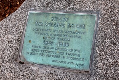
Plaque in front of Cousens Gym in Medford, MA, commemorating the former site of the Stearns Estate. The plaque reads, "Site of the Stearns Estate: A waystation on the Underground Railroad, a haven for slaves seeking freedom. 1850-1860. Placed here by members of the Tufts community, who continue to honor the tradition of sanctuary. Dedicated April 8, 1987." The plaque was dedicated one day shy of the 120th anniversary of the death of George L. Stearns. This photograph was taken in August 2017.