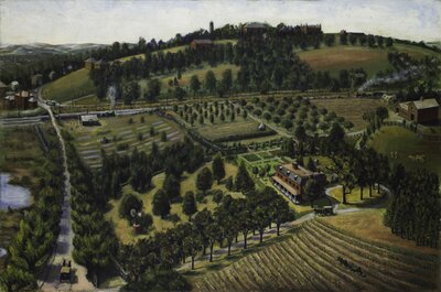
This painting shows the Stearns mansion in the center right and the farmhouse to the far right. In the distance on the hill are the buildings of Tufts College, with the tower of Goddard Chapel, East Hall, and West Hall visible through the trees. The road to the left is College Avenue; at the time it was known as the Willows because of the trees on either side. At the corner of College Avenue and the railroad tracks is College Hill train station. The Boston & Lowell Railroad operated on the tracks that separated Tufts College from the Stearns Estate's orchards.
Attribution:
William Hauk
Attribution Statement:
Image courtesy of the Tufts University Permanent Collection
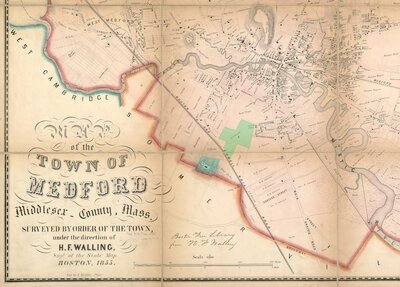
Excerpt from a map of Medford, 1855, showing South Medford, with the George L. Stearns Estate highlighted in green and Tufts College highlighted in blue near the center of the image.
Attribution:
Walling, Henry Francis; Kollner, Augustus
Attribution Statement:
Courtesy of the Norman B. Leventhal Map Center, Boston Public Library.
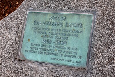
Plaque in front of Cousens Gym in Medford, MA, commemorating the former site of the Stearns Estate. The plaque reads, "Site of the Stearns Estate: A waystation on the Underground Railroad, a haven for slaves seeking freedom. 1850-1860. Placed here by members of the Tufts community, who continue to honor the tradition of sanctuary. Dedicated April 8, 1987." The plaque was dedicated one day shy of the 120th anniversary of the death of George L. Stearns. This photograph was taken in August 2017.